Thesis Highlights
New Orleans Public Space Project
New Orleans is a low-density city, spread from the high grounds near the Mississippi river into the low original swamps of its deltaic geography, with a problematic street system. Subsidence, lack of maintenance, extremely expensive construction requirements, aged and unkept urban infrastructures are some of the challenges of the street system of the city. In parallel, current water management infrastructure and practices, once the most advanced in the world, are obsolete and have provoked multiple unintended consequences. In the words of Professor Campanella: “the very water-manipulating devices needed to make this city prosper would rend it precarious”.
With most of New Orleans bowl transformed in built and impervious surfaces, most of the rainwater is pumped out, together with some of
the underground water, in order to keep the lower areas dry. The result is unwanted water over the surface of the streets and lack of water in the terrain, leading to subsidence and ultimately saline intrusion. This reversal of the place where water is needed comes with a substantial energy cost, fragility in front of any failure or misfunction, increased risk and astounding inequities in the risk and well-being of the most vulnerable situation.
Still imbued in the XIX and XX centuries mindset of specialization (architectural and infrastructural), water management, traffic, beautification, quality of life and heritage are most often addressed separately, in New Orleans and in most of the rest of the world. The New Orleans Public Space Project tries to contribute to a better understanding of the relations between the different urban systems that construct the city’s public space and streetscape; develop scenarios in which new approaches in mobility, water management, urban ecology, livability and heritage may end in potential city scale interventions; and ultimately spark pilot tests to prove those scenarios.
WORK
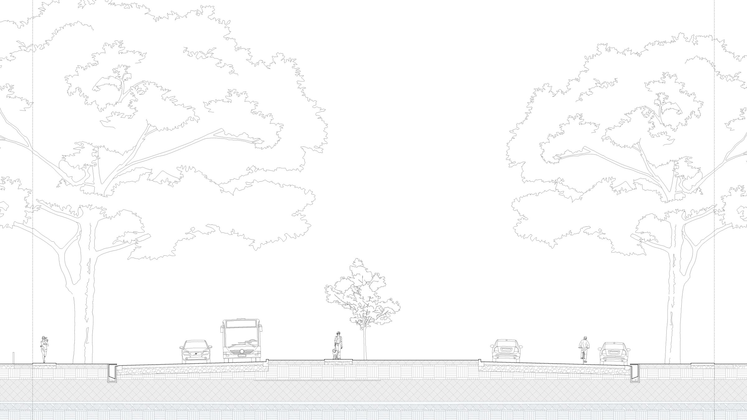
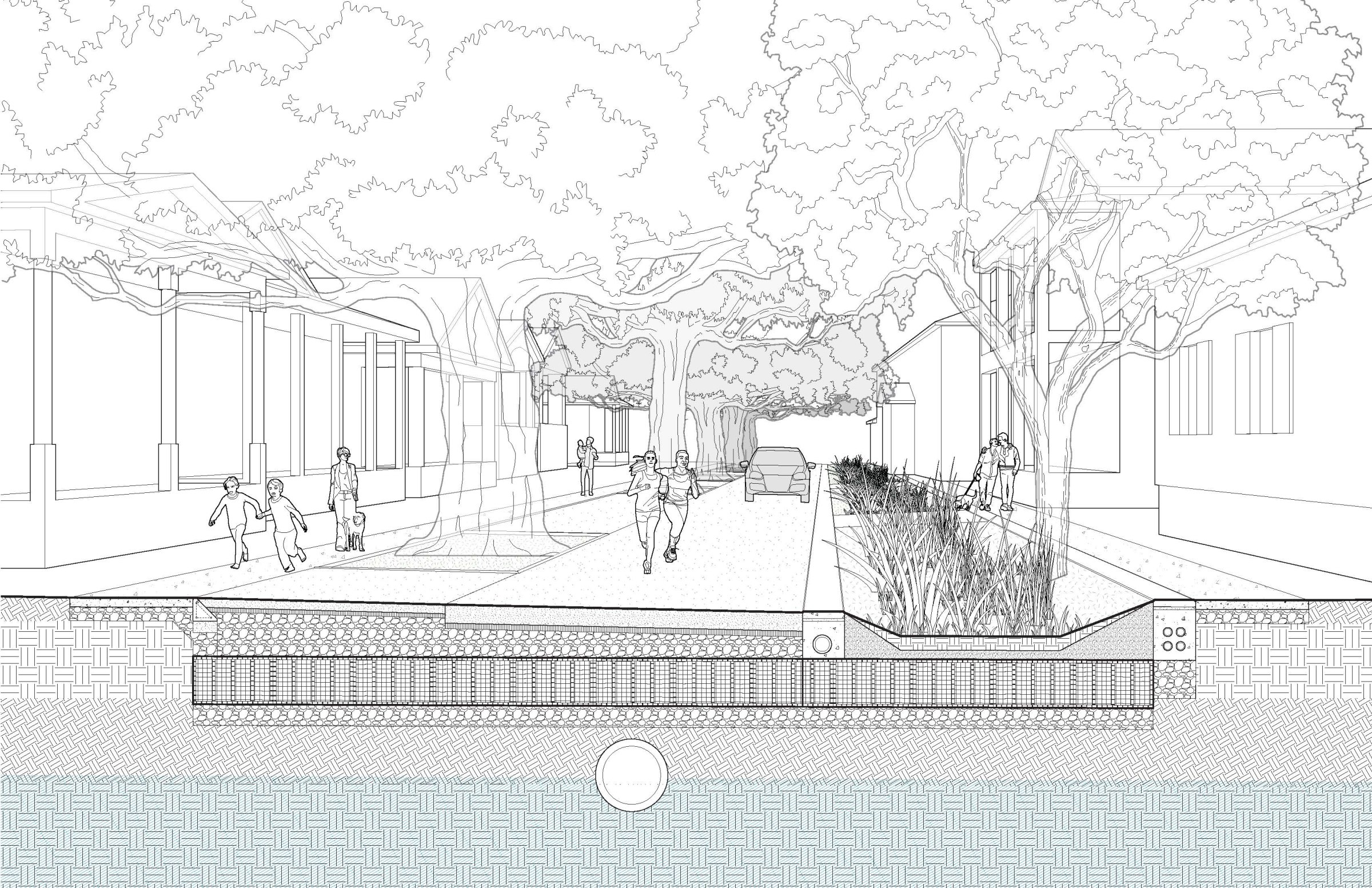
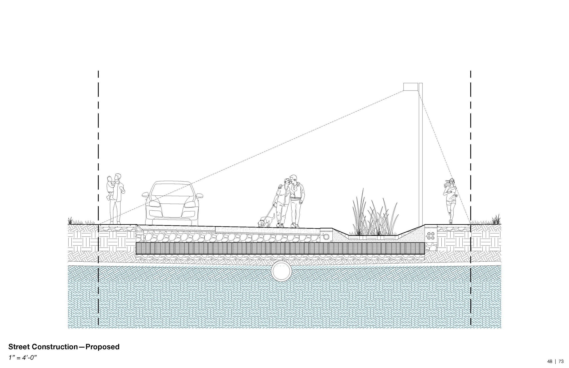
"A People's Promenade"
Sara Bhatia
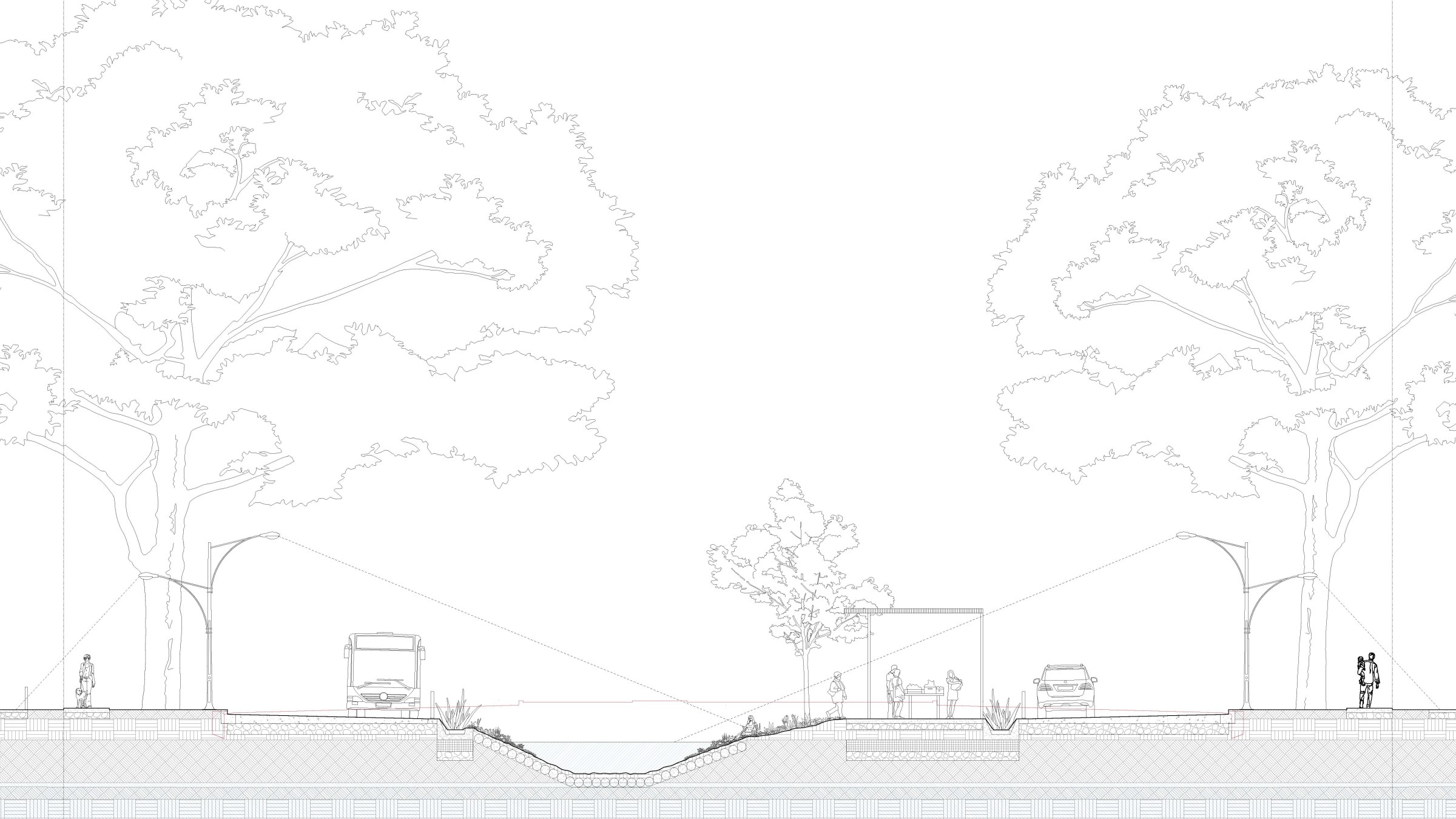
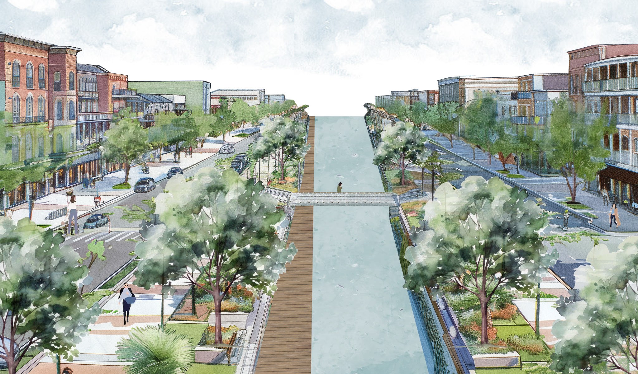
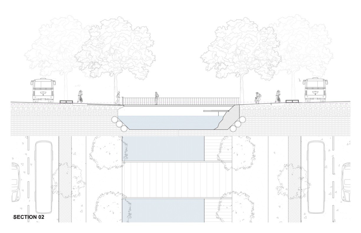
Reimagining of Napoleon Avenue as a space both to manage water and for the public to engage with water as a resource and for recreation. This includes rethinking the Napoleon corridor with transit-priority infrastructure and adjusting the right-of-way for public and pedestrian use.
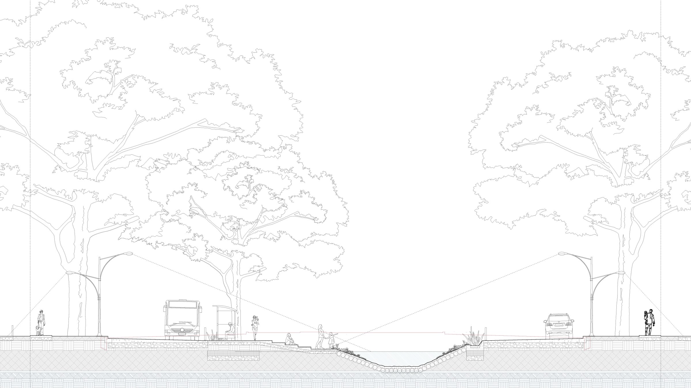
Reimagining Magazine Street as a pedestrian-first promenade with limited automotive access to better serve as a walkable pedestrian commercial corridor. Reclaiming space dedicated to storing cars allows for more street-front eateries, outdoor shopping and circulator transit. This space also becomes performant as water-management infrastructure in alignment with surrounding blocks.
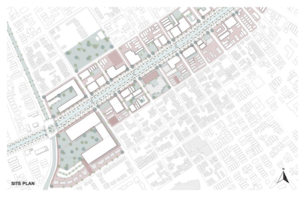
"A Vision for Vibrancy on South Claiborne Avenue"
An Le
South Claiborne Avenue is an underutilized commercial corridor and artery for the city of New Orleans and can be to the 21st century what St. Charles Avenue was for the 19th and 20th centuries. This corridor connects Tulane University's Uptown campus with the University Medical Center, Charity Hospital redevelopment and Tulane University's Downtown campus, giving access to some of the largest employers in the city.
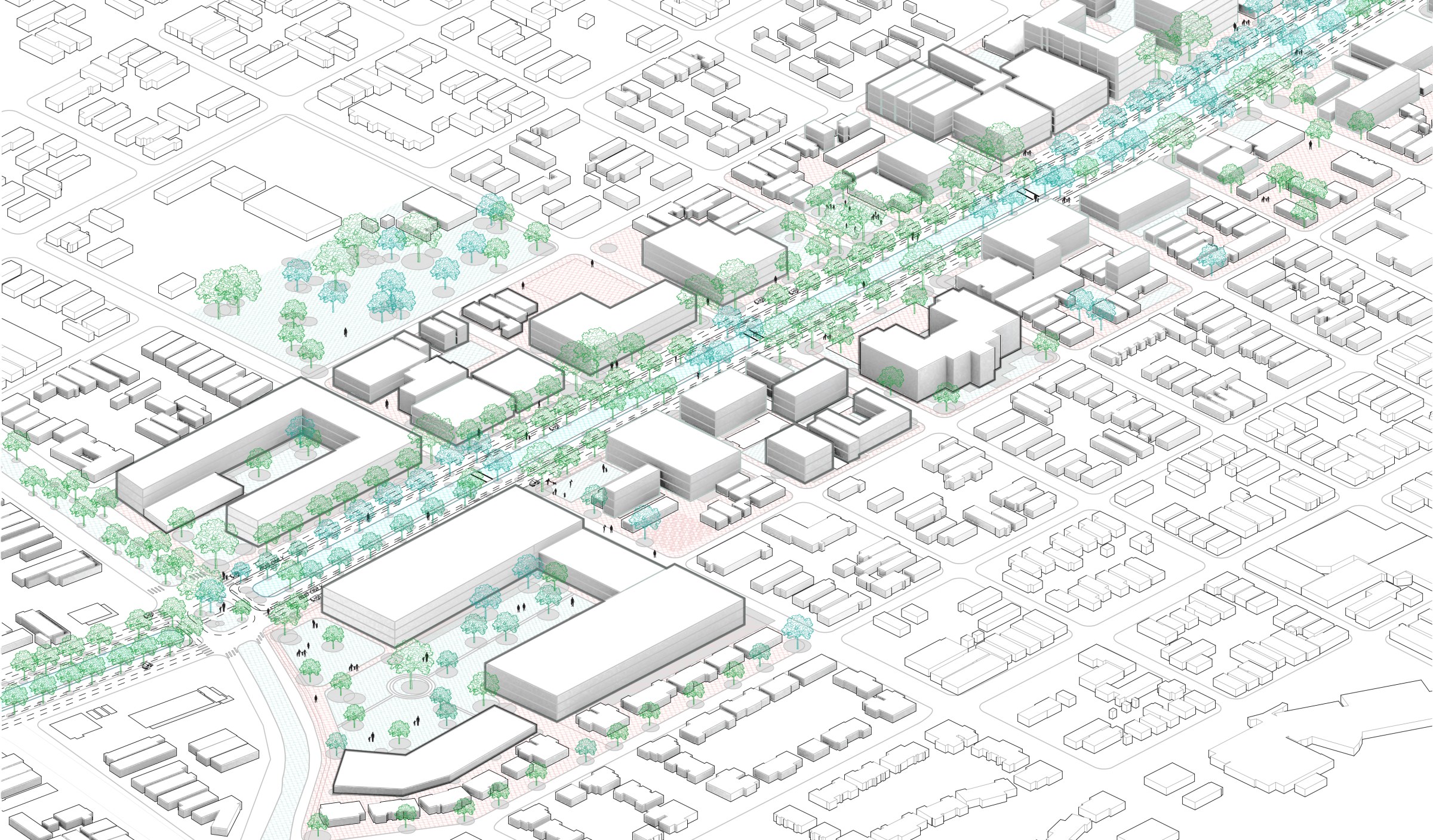
However, South Claiborne does not adequately support this connection and could be rethought as a thriving commercial corridor focused into distinct zones along its length.
This project proposes rethinking the development of this corridor through a case study along its length. First, the neutral ground is considered as a public amenity and a space to manage stormwater in a way where it can be treated as a resource. Then, the vital traffic along the road is considered, replacing parallel parking with dedicated bus stops and lanes to prioritize function. Finally, the highest and best use for the developable land along the corridor is considered, proposing densification to better serve existing community needs and also the greater connections fostered by this redesign.